Parkday started as a test of Foundry and became our next app
We needed a real job to put through Foundry. The first working version of Parkday showed us what it could be, so we spent the next week building it out.
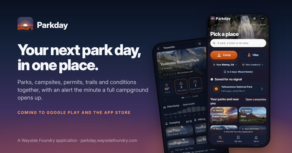
Parkday began as a test. We were building Foundry, the system that takes an app from a written product brief to a published web app, and we needed to see whether it could actually do that from end to end.
Foundry runs on two pieces we have written about before. Castings is our library of parts that have already run in a live app and passed their tests, so a new app starts from proven pieces instead of building them again. Ore is our list of public data sources whose terms allow commercial use, checked every week and reached through one door, so an app can ask for the weather or a park's alerts without ever holding a key. An assembly line for applications covers the line that runs it all.
We gave Foundry a product brief for a park conditions app and let it run. What came out the other end was the first working version of Parkday, built from Castings and fed by Ore. It was small: one park, one trailhead, one screen. But when we opened it, the value was right there. A park, its conditions, and what you need to know before you go, in one place.
So we kept going. We spent the next week on detailed development and fine tuning: campgrounds and permits, trails and maps that work with no signal, the alerts, the design, and its own website. Almost every new feature started the same way, with a new source added to Ore, and every app we build after Parkday gets those sources on day one.
What Parkday is
Parkday puts the park, the campsites, the permits, the trails and the conditions in one place, for a first trip or your fiftieth. It works the same way on every park, campground and trail. You pick a place. You see what it is like: weather, air, water, closures and fire. You add trails and campgrounds to your plan. Then you get in: book when sites are open, get a reminder before booking opens, or watch a full campground.
Behind that are 27 public sources and 77 kinds of answers, from the National Park Service, Recreation.gov, the National Weather Service, USGS, AirNow, the National Interagency Fire Center and others.
Why we think it changes how people camp and hike
Planning a park day today means a dozen tabs. Recreation.gov for a site, the park's own pages for alerts and fees, the Weather Service, an air quality map, a river gauge, a trail map, a land map. People who love to camp and hike already do all of that for every trip, and they do it again the night before because conditions change. Parkday puts it on one page for each park, so the time goes into the trip and not the planning.
The campsite is the other half. Popular campgrounds book out months ahead, and when someone cancels, the site goes to whoever hears first. Parkday watches a full campground and tells you within minutes when a site opens up.
It also has to work where the trip actually happens. Parks and trails can be saved for no signal, so the map and the plan are still there when the phone has no service.
And it is honest about what it knows. Every reading names the agency it came from and when it was read, so you can check it yourself. Parkday never books for you; you book, apply or enter a lottery on the agency's own site. Your exact location stays on your phone.
None of these sources is new. Every one of them already exists, and people who plan trips already use them. What is new is having all of them in one place, with each answer showing where it came from, and an alert when the site you wanted opens up. That is why we think Parkday will change how people camp and hike.
Where it is now
Parkday is coming to Google Play and the App Store. If you want to hear the day it does, get on the launch list at parkday.waysidefoundry.com.
If you have used a park app and wished it did one thing it does not, tell us on X. We are still building.